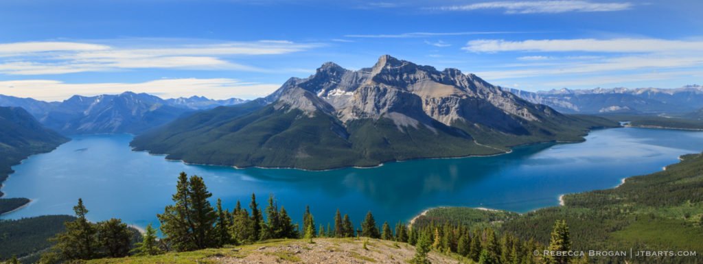
Aspens Panorama 4 (Lake Minnewanka, Banff National Park)

LANDSCAPE PHOTOGRAPHY > BANFF NATIONAL PARK AND CANMORE REGION — CANADA > Aspens Panorama 4 (Lake Minnewanka, Banff National Park) Print Code: BANF26 | Print Sizes: S, M, L, Oversize | Contact for Prints Lake Minnewanka is an impressive 21 km (13 mi) long lake in Banff National Park. It bends around picturesque Mt. Inglismaldie […]
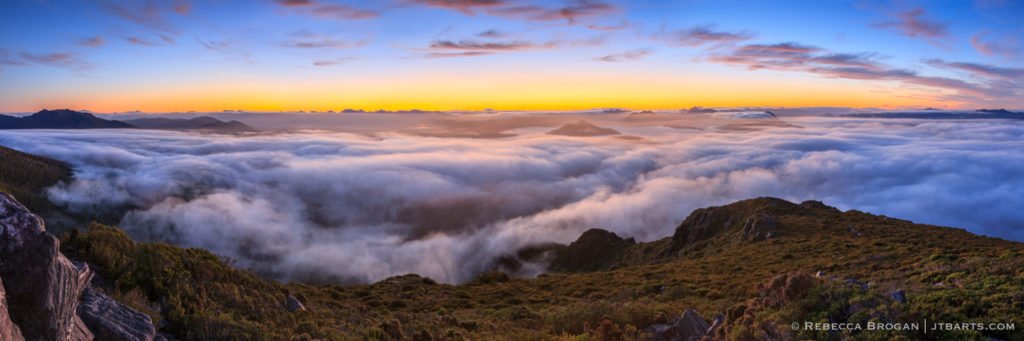
Snowy Florentine Peak from The Rodway Range (Mt. Field National Park)

Print Code:
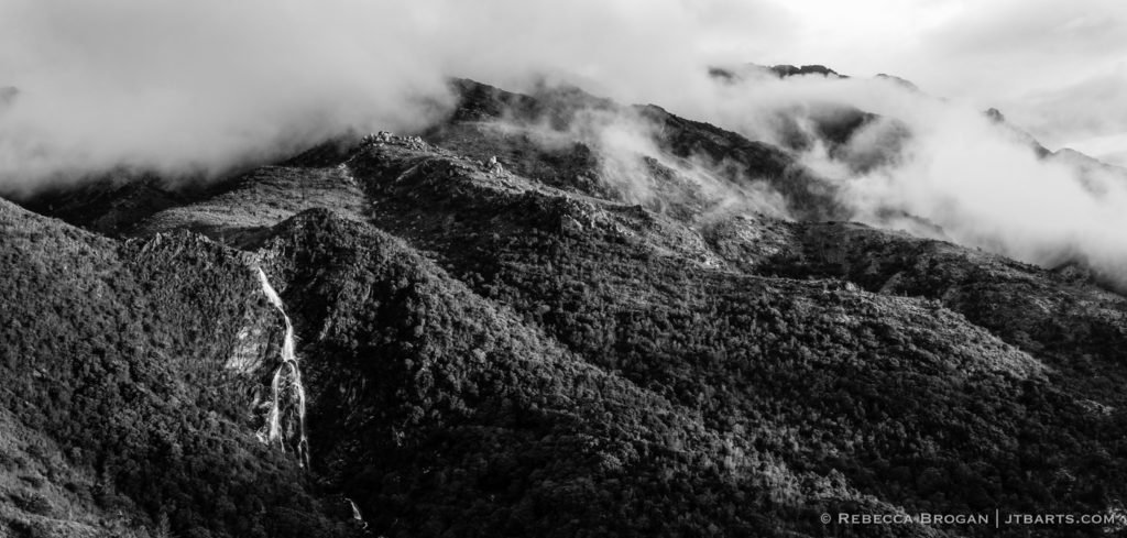
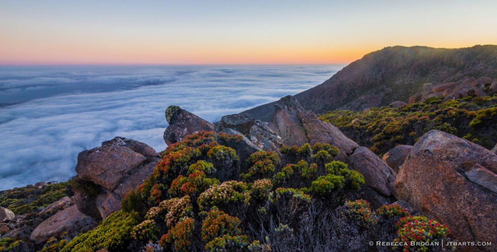
Last Light on The Rodway Range (Mt. Field National Park) black and white

Print Code:
Tasmanian Rainforest Panorama (Franklin – Gordon Wild Rivers National Park)

Print Code:
Lake Louise Morning Panorama (Banff National Park)

LANDSCAPE PHOTOGRAPHY > BANFF NATIONAL PARK AND CANMORE REGION 2 — CANADA > Lake Louise Morning (Banff National Park) Print Code: BANF7 | Print Sizes: S, M, L, Oversize | Contact for Prints Lake Louise is one of the most beautiful areas in Banff National Park and a well-loved landmark. The brilliant turquoise colors of Lake […]
Aylmer Lookout Over Mt. Inglismaldie and Mt. Girouard (Lake Minnewanka, Banff National Park)
LANDSCAPE PHOTOGRAPHY > BANFF NATIONAL PARK AND CANMORE REGION — CANADA > Aylmer Lookout Over Mt. Inglismaldie and Mt. Girouard (Lake Minnewanka, Banff National Park) Print Code: BANF28 | Print Sizes: S, M, L, Oversize | Contact for Prints Lake Minnewanka is an impressive 21 km (13 mi) long lake in Banff National Park. It […]
Clearing Peaks Panorama (Canmore, Alberta) black and white
LANDSCAPE PHOTOGRAPHY > BANFF NATIONAL PARK AND CANMORE REGION — CANADA > Clearing Peaks Panorama (Canmore, Alberta) black and white Print Code: BANF10 | Print Sizes: S, M, L, Oversize | Contact for Prints I was camping in Canmore one morning when my husband woke me up and told me I needed to grab my […]
Aspens Panorama 2 (Lake Minnewanka, Banff National Park)

LANDSCAPE PHOTOGRAPHY > BANFF NATIONAL PARK AND CANMORE REGION — CANADA > Aspens Panorama 2 (Lake Minnewanka, Banff National Park) Print Code: BANF24 | Print Sizes: S, M, L, Oversize | Contact for Prints Lake Minnewanka is an impressive 21 km (13 mi) long lake in Banff National Park. It bends around picturesque Mt. Inglismaldie […]
Morning Mist on The Mountains 2 (Canmore, Alberta)
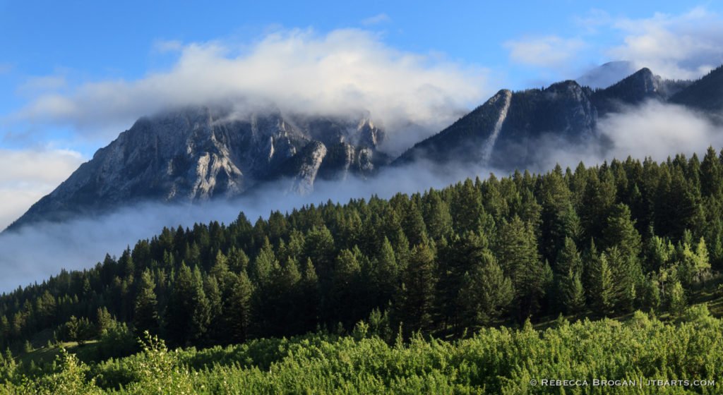
LANDSCAPE PHOTOGRAPHY > BANFF NATIONAL PARK AND CANMORE REGION — CANADA > Morning Mist on The Mountains 2 (Canmore, Alberta) Print Code: BANF3 | Print Sizes: S, M, L, Oversize | Contact for Prints I was camping in Canmore one morning when my husband woke me up and told me I needed to grab my […]
Aspens Panorama 3 (Lake Minnewanka, Banff National Park)
LANDSCAPE PHOTOGRAPHY > BANFF NATIONAL PARK AND CANMORE REGION — CANADA > Aspens Panorama 3 (Lake Minnewanka, Banff National Park) Print Code: BANF25 | Print Sizes: S, M, L, Oversize | Contact for Prints Lake Minnewanka is an impressive 21 km (13 mi) long lake in Banff National Park. It bends around picturesque Mt. Inglismaldie […]
Grand Prismatic Spring Panorama (Yellowstone National Park)
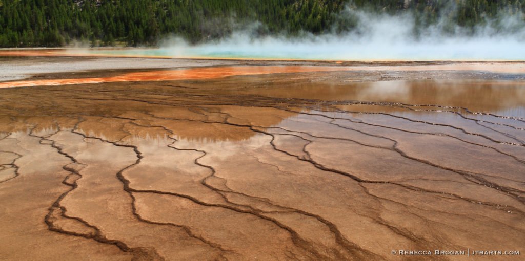
LANDSCAPE PHOTOGRAPHY > YELLOWSTONE NATIONAL PARK > Grand Prismatic Spring Panorama (Yellowstone National Park) Print Code: YNP6 | Print Sizes: S, M, L, Oversize | Contact for Prints Grand Prismatic Spring is my favorite feature in Yellowstone National Park. The amazing patterns and especially the rainbow colors of the spring captivate my artistic eye. Thermophiles (Greek […]
Dawson Pass Panorama 1 (Two Medicine, Glacier National Park)

LANDSCAPE PHOTOGRAPHY > GLACIER NATIONAL PARK – USA > Dawson Pass Panorama 1 (Two Medicine, Glacier National Park) Print Code: GNP10 | Print Sizes: S, M, L, Oversize | Contact for Prints The area of Two Medicine within Glacier National Park is very important to the Blackfeet Nation. Sinopah Mountain provides a dramatic skyline that […]
Two Medicine Panorama (Glacier National Park)

LANDSCAPE PHOTOGRAPHY > GLACIER NATIONAL PARK – USA > Two Medicine Panorama (Two Medicine, Glacier National Park) Print Code: GNP8 | Print Sizes: S, M, L, Oversize | Contact for Prints The area of Two Medicine within Glacier National Park is very important to the Blackfeet Nation. Sinopah Mountain provides a dramatic skyline that is […]
Haystack Butte Panorama (The Highline Trail, Glacier National Park)
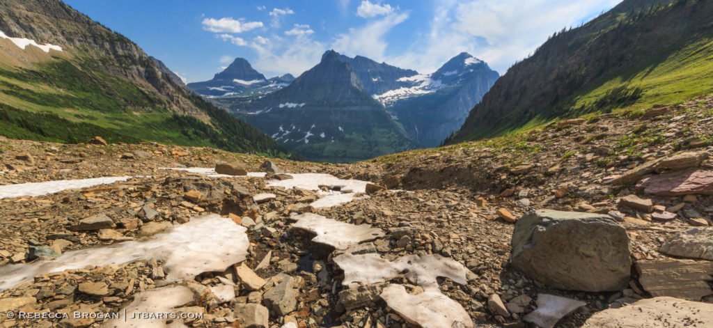
LANDSCAPE PHOTOGRAPHY > GLACIER NATIONAL PARK – USA > Haystack Butte Panorama (The Highline Trail, Glacier National Park) Print Code: GNP25 | Print Sizes: S, M, L, Oversize | Contact for Prints The Highline Trail begins at Logan Pass, the highest point on Going-to-The-Sun Road, and traverses the mountainside on its 7.6 mi (12 km) […]
Dawson Pass Looking Over Two Medicine (Glacier National Park)

LANDSCAPE PHOTOGRAPHY > GLACIER NATIONAL PARK – USA > Dawson Pass Looking Over Two Medicine (Two Medicine, Glacier National Park) Print Code: GNP9 | Print Sizes: S, M, L, Oversize | Contact for Prints The area of Two Medicine within Glacier National Park is very important to the Blackfeet. Sinopah Mountain provides a dramatic skyline […]
Building Clouds Over Sinopah Panorama (Two Medicine, Glacier National Park)
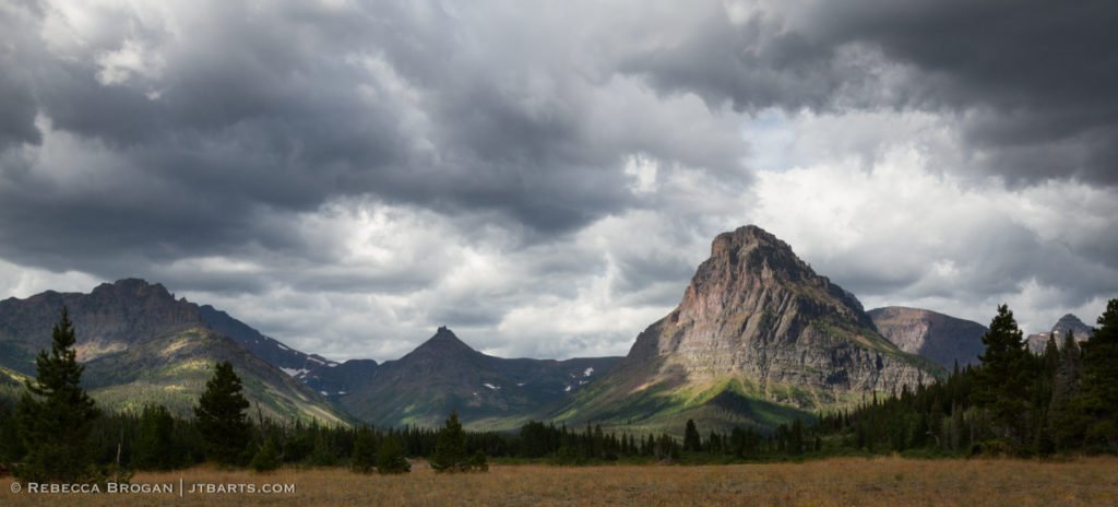
LANDSCAPE PHOTOGRAPHY > GLACIER NATIONAL PARK – USA > Building Clouds Over Sinopah Panorama (Two Medicine, Glacier National Park) Print Code: GNP5 | Print Sizes: S, M, L, Oversize | Contact for Prints The area of Two Medicine within Glacier National Park is very important to the Blackfeet Nation. Sinopah Mountain provides a dramatic skyline […]
St. Mary’s Panorama (Glacier National Park)
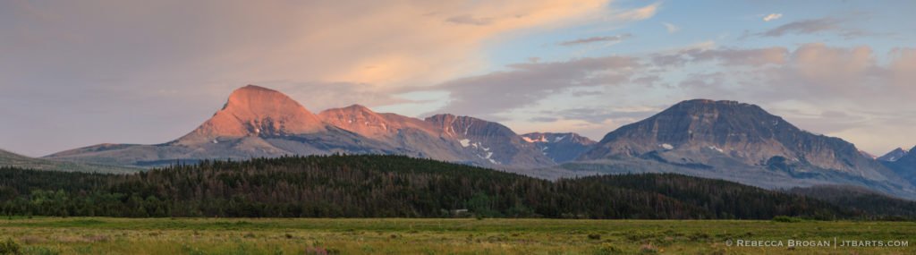
LANDSCAPE PHOTOGRAPHY > GLACIER NATIONAL PARK – USA > St. Mary’s Panorama (Glacier National Park) Print Code: GNP1 | Print Sizes: S, M, L, Oversize | Contact for Prints This panorama photograph was taken from St. Mary’s in eastern Glacier National Park when the last of the summer sun was striking the mountain peaks. St. […]
Grand Teton and Mt. Owen Panorama (Grand Teton National Park) black and white

LANDSCAPE PHOTOGRAPHY > GRAND TETON NATIONAL PARK 2 – USA > Grand Teton and Mt. Owen Panorama (North Fork, Grand Teton National Park) black and white Print Code: GTNP25 | Print Sizes: S, M, L, Oversize | Contact for Prints Grand Teton (13,775′, 4198m) is the highest peak in the Cathedral Group. This panorama photograph […]
Grand Teton and Mt. Owen Panorama (North Fork, Grand Teton National Park)

LANDSCAPE PHOTOGRAPHY > GRAND TETON NATIONAL PARK – USA > Grand Teton and Mt. Owen Panorama (North Fork, Grand Teton National Park) Print Code: GTNP24 | Print Sizes: S, M, L, Oversize | Contact for Prints Grand Teton (13,775′, 4198m) is the highest peak in the Cathedral Group. This panorama photograph of Grand Teton peak […]
Grand Tetons Sunrise Panorama (South Fork, Grand Teton National Park)
LANDSCAPE PHOTOGRAPHY > GRAND TETON NATIONAL PARK – USA > Grand Tetons Sunrise Panorama (South Fork, Grand Teton National Park) Print Code: GTNP23 | Print Sizes: S, M, L, Oversize | Contact for Prints This panorama photograph of sunrise over the Grand Tetons was taken near Hurricane Pass in the Cascade Canyon South Fork. I […]
Grand Teton and Mt. Owen Moonrise Panorama (North Fork, Grand Teton National Park)
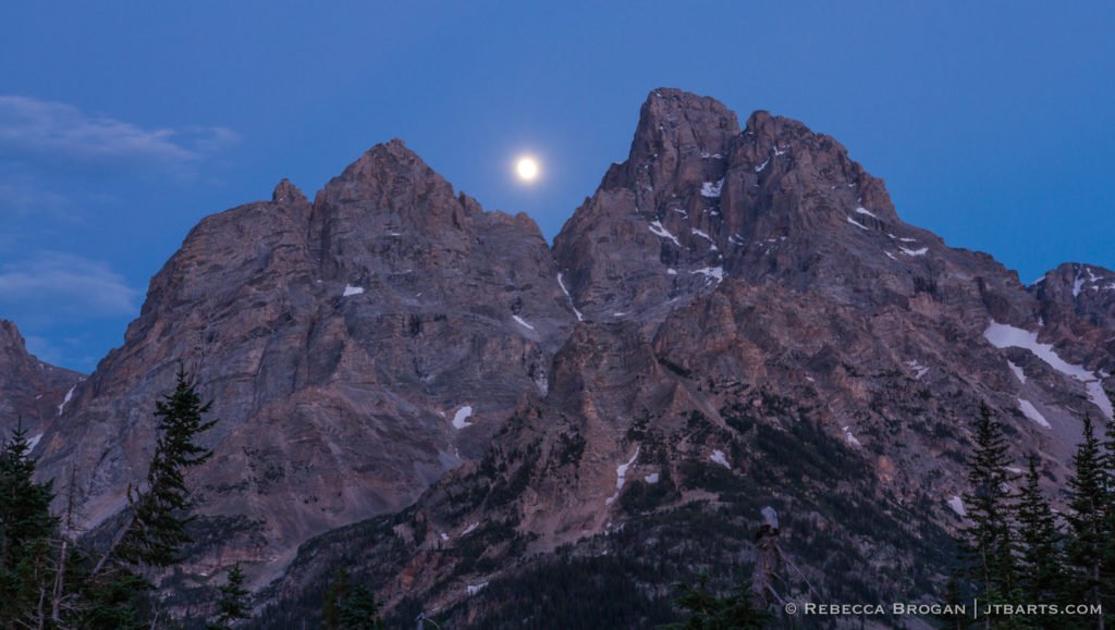
LANDSCAPE PHOTOGRAPHY > GRAND TETON NATIONAL PARK – USA > Grand Teton and Mt. Owen Moonrise Panorama (North Fork, Grand Teton National Park) Print Code: GTNP17 | Print Sizes: S, M, L, Oversize | Contact for Prints The full moon rose perfectly between Grand Teton (13,775′, 4198m) and Mt. Owen (12,928′, 3920 m), the highest […]
Grand Teton and Mt. Owen Sunset Panorama (North Fork, Grand Teton National Park)

LANDSCAPE PHOTOGRAPHY > GRAND TETON NATIONAL PARK – USA > Grand Teton and Mt. Owen Sunset Panorama (North Fork, Grand Teton National Park) Print Code: GTNP16 | Print Sizes: S, M, L, Oversize | Contact for Prints This panorama photograph of Grand Teton (13,775′, 4198m) and Mt. Owen was taken from the Cascade Canyon North […]
Horsetail Falls (Queenstown, West Coast) black and white
Print Code:
Full Moonrise Over Lake Cygnus (Western Arthur Range, Southwest National Park)

Print Code: SWWAR10
Western Arthurs Sunset Panorama from Junction Creek (Arthur Plains, Southwest National Park)

Print Code: SWWAR6
The South Coast of Tasmania Panorama 1 (South Coast Track, Southwest National Park)
Print Code: SWSCT6
South Cape Bay Lion Rock Sunset Panorama (South Coast Track, Southwest National Park)

Print Code: SWSCT9
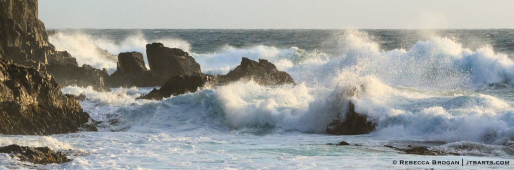
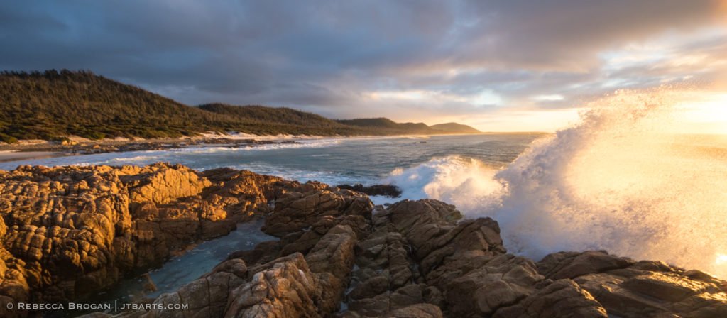
Ocean Meets Shore on Tasmania’s South Coast (South Cape Bay, South Coast Track, Southwest National Park)

Print Code: SWSCT7
The South Coast of Tasmania Panorama 2 (South Coast Track, Southwest National Park)

Print Code: SWSCT4
Mt. Anne and Lake Pedder 360 Panorama (Mt. Anne Track, Southwest National Park)

Print Code:
Deception Ridge in The Clouds (High Camp, Mt. Eliza, Mt. Anne Track, Southwest National Park)

Print Code:
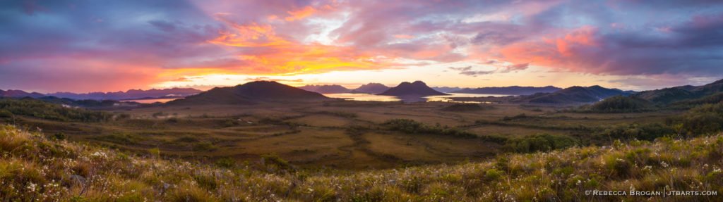
Lake Pedder Sunset Panorama from Mt. Eliza (Mt. Anne Track, Southwest National Park)

Print Code:
Mt. Solitary Enshrouded in Cloud Panorama (Lake Pedder from Mt. Eliza, Mt. Anne Track, Southwest National Park) black and white

Print Code:
Breaking Rainstorm Over Lake Pedder Sunset Panorama SMALL (Mt. Eliza, Mt. Anne Track, Southwest National Park)
Print Code:
Breaking Rainstorm Over Lake Pedder Sunset Panorama LARGE (Mt. Eliza, Mt. Anne Track, Southwest National Park)

Print Code:
Mt. Anne Plateau Panorama (Mt Eliza, Mt. Anne Track, Southwest National Park)

Print Code:
Twilight Over Lake Pedder Panorama (High Camp, Mt. Eliza, Mt. Anne Track, Southwest National Park)

Print Code:
Mt. Anne Track Panorama of Lot’s Wife and Lightning Ridge (Mt. Anne Track, Southwest National Park)

Print Code:
Building Mist Over Lake Pedder Panorama (High Camp, Mt. Eliza, Mt. Anne Track, Southwest National Park)
Print Code:
Last Light on The Rodway Range (Mt. Field National Park)

Print Code:
Sun Rays Over The Florentine Valley (Mt. Field National Park)

Print Code:
Derwent Jerry Sunrise (Collins Cap, Wellington Park, Wellington Range, Hobart)

Print Code:
Kunanyi / Mt. Wellington Summit at Dusk Panorama (Wellington Range, Wellington Park, Hobart)
Print Code:
Sunset Over The Derwent Valley Panorama (Collins Cap, Wellington Range, Wellington Park, Hobart)

Print Code:
Richardsons Beach Sunset Panorama (NARROW) (Freycinet National Park)
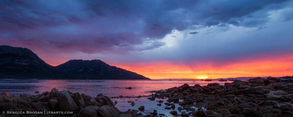
Print Code:
Richardsons Beach Sunset Panorama (Freycinet National Park)
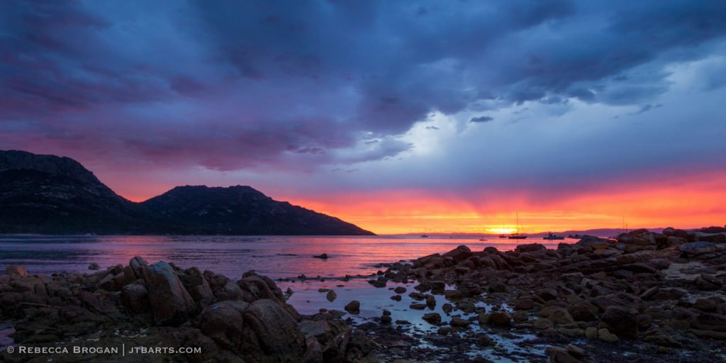
Print Code:
Friendly Beaches Sunrise Storm (Freycinet National Park)
Print Code:
Horsetail Falls (Queenstown, West Coast)

Print Code:
Franklin – Gordon Sunrise (Franklin – Gordon Wild Rivers National Park)
Print Code:
Mt. Ossa Summit Panorama (The Overland Track, Cradle Mountain – Lake St. Clair National Park)
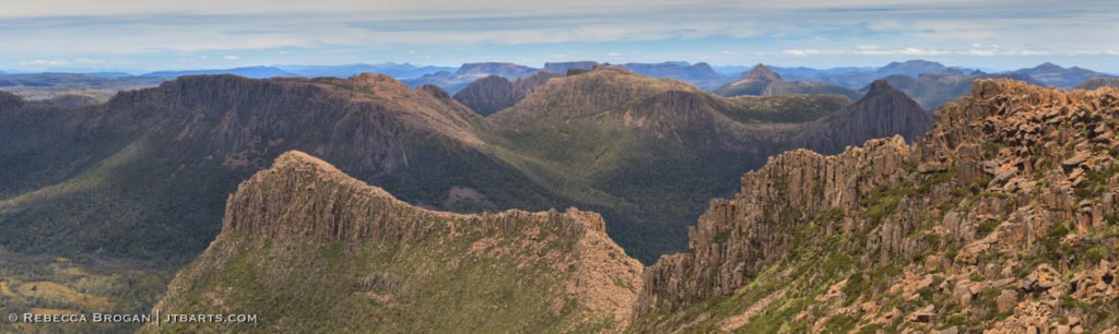
Print Code:
Mt. Ossa (The Overland Track, Cradle Mountain – Lake St. Clair National Park) black and white

Print Code:
Cradle Mountain Winter Reflections in Dove Lake Panorama (Cradle Mountain – Lake St. Clair National Park)

Print Code:
Snowy Cradle Mountain SMALL Panorama (Cradle Mountain – Lake St. Clair National Park)

Print Code:
Snowy Cradle Mountain LARGE Panorama (Cradle Mountain – Lake St. Clair National Park)

Print Code:
Cradle Mountain from The Overland Track (Cradle Mountain – Lake St. Clair National Park)

LANDSCAPE PHOTOGRAPHY > CRADLE MOUNTAIN – LAKE ST. CLAIR NATIONAL PARK AND THE OVERLAND TRACK – TASMANIA > Cradle Mountain from The Overland Track (Cradle Mountain – Lake St. Clair National Park) PURCHASE THIS PRINT – Print Code: CRAD3 Print Sizes: S, M, L, Oversize | Postcards Cradle Mountain is Tasmania’s foremost natural icon and marks […]
Aurora Australis Over Seven Mile Beach (Hobart)

excerpt goes here
Aurora Australis Over Hope Beach (Goats Bluff, South Arm, Hobart)
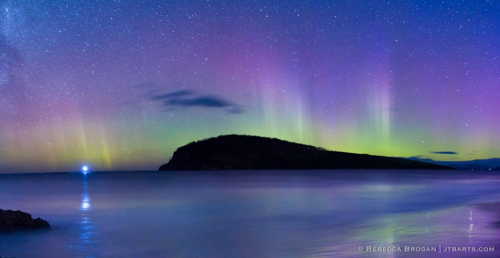
LANDSCAPE PHOTOGRAPHY > AURORA AUSTRALIS, MILKY WAY AND BIOLUMINESCENCE – TASMANIA > Aurora Australis Over Hope Beach (Goats Bluff, South Arm, Hobart) PURCHASE THIS PRINT – Print Code: AUR4 Print Sizes: S, M, L, Oversize | Postcards The Aurora Australis appears over Hobart, Tasmania, but what causes it? The sun releases particles of plasma (which we call “solar […]
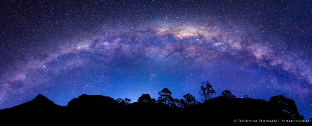
The Heavens Over The Labyrinth (Cradle Mountain – Lake St. Clair National Park)
Print Code: